Get Floor Plans for any existing space
So you won the renovation bid and now it’s time to start planning out the project.
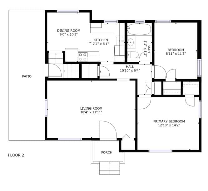
Now you just need a set of accurate floor plans to get permits and start the Take Off process. But what do you do when the building is old and plans are not available or when there have been numerous add-ons since construction and the original plans are no longer accurate?
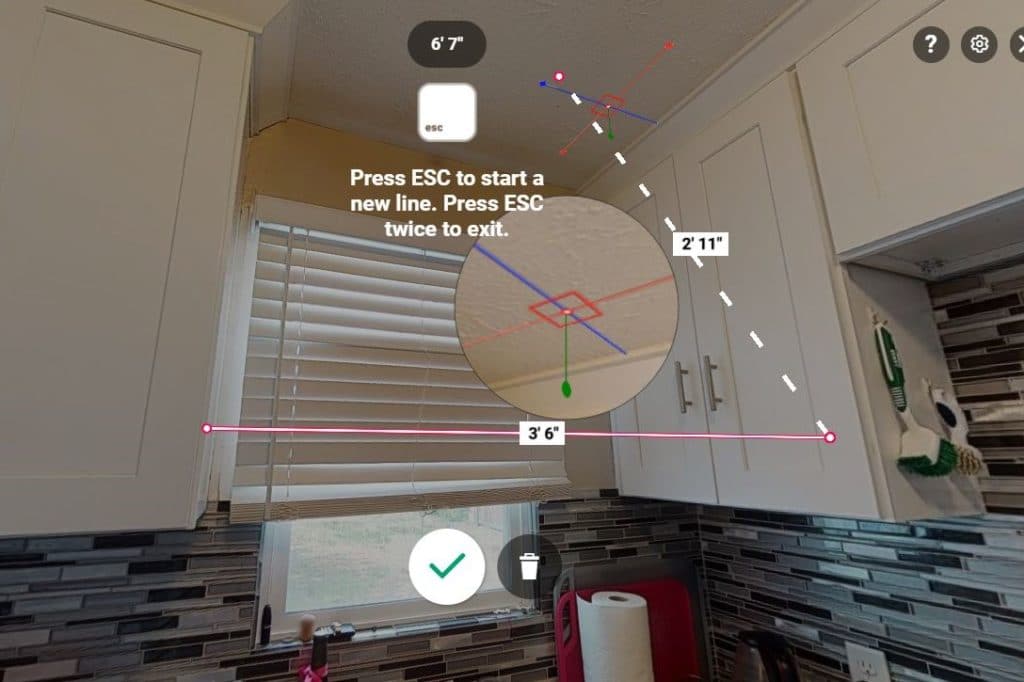
All you need to do is call us at scatterscape. We will come out and 3D scan your property and draft up a set of floor plans for you!
Multiple formats including DXF, DWG & PDF available.
We have a variety of 3D equipment including Leica BLK 360 G2, Matterport and more and we service UT, ID, OK, AR, the DMV area, TX and more.
No more tape measure madness.
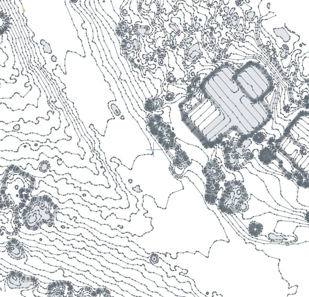
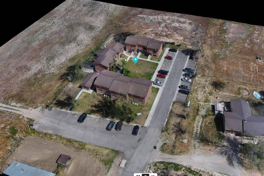
Site plan creation
As drone technology improves, many contractors are realizing the power of using drone aerial survey to create a Site Plan, get topographical and elevation data and even making ad hoc measurements for landscape or utility planning.
Our solution allows you to get the data you need in a variety of formats including DXF, ShapeFile, PDF and more.
We can even create the site plan for you with elevation and
We love all projects large and small.
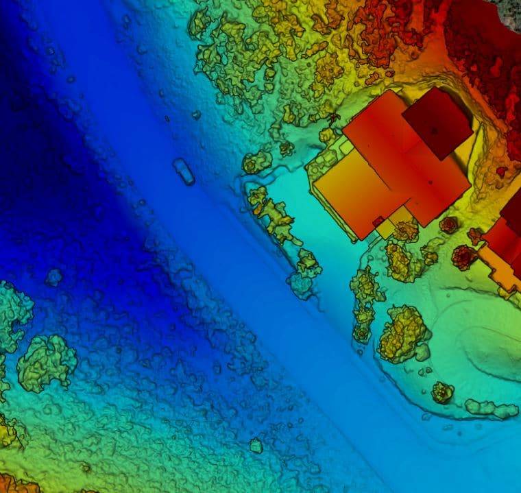
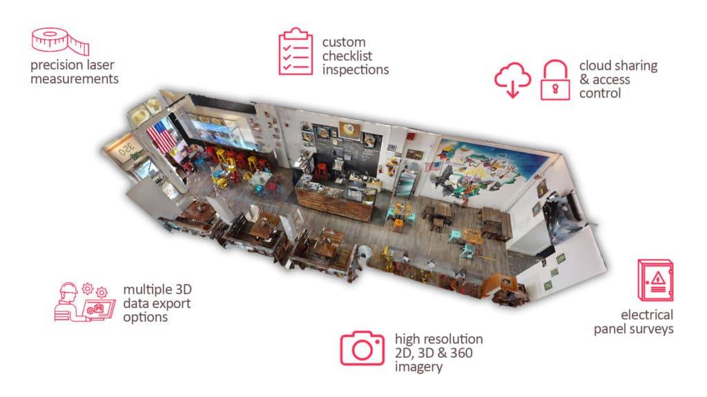
Power your planning with 3D assets
What was once science fiction is now a reality that is changing the building industry. Play around with the site tour on the left to see how amazing this incredibly affordable technology can be for your projects.
Monitor progress. Empower your employees and sub-contractors. Take measurements and make plans, all in an easy-to-access 3D environment.
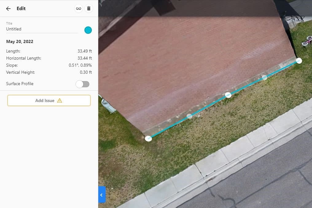
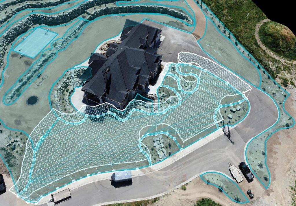
Get accurate surface area estimates
What if you could easily boost your subcontractor business with more accurate estimates of land area? Imagine basing your next order of sod, mulch or asphalt based on an accurate measurement of the actual surface area? Hills, valleys, irregular borders are no problem for Scatterscape.
All trades welcome!
Experienced. Available. Ready-to-go.
3D Scanning, precise laser tape measurements, photo documentation of electrical and HVAC – we do it all.
Scatterscape,
a better experience.
The world is hectic enough. Scatterscape can make it a little less so.
One vendor, more coverage
Bid more jobs with confidence! Our multi-regional footprint is growing all the time. We're putting more trained 3D techs in more places--all with one center point of contact for you.
No Hassles.
You'll never have to deal with "that's not our job" mentality at scatterscape. We're pros and we do what we love.
Constant improvement
Reality Capture & Site survey jobs can vary widely in their goals and requirements. We always work to take what we've learned and improve our offerings along the way.
The fastest growing
On-Demand capture specialists
Don’t believe us? Check the numbers. Scatterscape is the fastest-growing disruptor in on-demand space capture.